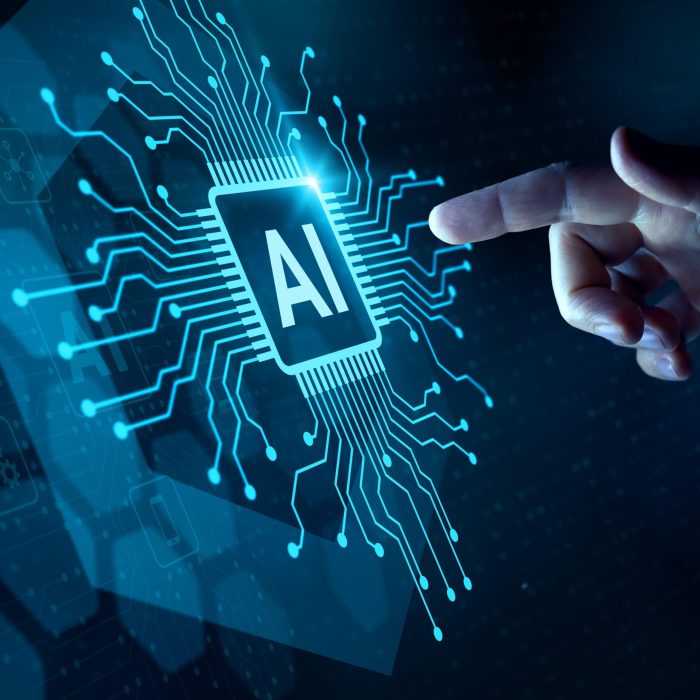
Artificial Intelligence App for Measuring Distance An In-Depth Analysis
Artificial intelligence app for measuring distance represents a fascinating intersection of computer vision, sensor technology, and advanced algorithms. This application, leveraging the power of AI, promises to revolutionize how we perceive and interact with space. The development of such an app necessitates a thorough understanding of underlying principles, from the intricacies of stereo vision and time-of-flight to the practical implementation of these concepts in code.
The following discussion will explore the diverse facets of this innovative technology.
We will dissect the core components, including sensor selection, algorithm design, and user interface considerations. The exploration will encompass the crucial aspects of platform deployment, ethical implications, real-world applications, testing methodologies, and data security. Further analysis will focus on the competitive landscape and the potential for future advancements, paving the way for a comprehensive understanding of the artificial intelligence app for measuring distance.
Exploring the fundamental concepts underpinning an AI-powered distance measurement application is essential for comprehension.

The development of an AI-powered distance measurement application relies on a robust understanding of computer vision principles. These principles enable the application to analyze visual data and estimate distances to objects within a scene. This analysis involves various techniques, each with its strengths and weaknesses, influencing the overall performance and suitability of the application for different scenarios.
Core Principles of Computer Vision for Distance Estimation
Several computer vision techniques facilitate distance estimation. These techniques include stereo vision, monocular vision, and time-of-flight, each leveraging different aspects of image acquisition and processing.
- Stereo Vision: Stereo vision mimics human binocular vision by using two or more cameras to capture images of a scene from slightly different viewpoints. The disparity, or the difference in the position of a feature in the images from the different cameras, is then used to calculate the distance. This is based on triangulation, where the distance is calculated using the baseline (distance between the cameras), the focal length of the cameras, and the disparity.
- Monocular Vision: Monocular vision utilizes a single camera to estimate distance. It relies on various cues, such as the size of known objects, texture gradients, and perspective. For instance, if the size of an object is known, the apparent size in the image can be used to estimate its distance.
- Time-of-Flight (ToF): Time-of-flight sensors emit a signal, typically infrared light, and measure the time it takes for the signal to return after reflecting off an object. This time is directly proportional to the distance to the object.
The fundamental principle is based on the geometry of similar triangles. Consider two cameras, A and B, separated by a baseline ‘b’. An object point ‘P’ is projected onto the image planes of both cameras at points ‘pA’ and ‘pB’, respectively. The disparity ‘d’ is the horizontal distance between ‘pA’ and ‘pB’. The distance ‘Z’ to the object is then calculated using the following formula:
Z = (b
– f) / d
Where ‘f’ is the focal length of the cameras.
Perspective cues, such as the convergence of parallel lines, are crucial. Consider a road that appears to narrow as it recedes into the distance. The rate at which the road narrows provides information about the distance to different points on the road. The size of a known object can also be used. If the actual height ‘H’ of an object is known, and its apparent height ‘h’ in the image is measured, and the focal length ‘f’ and the camera’s distance to the object ‘Z’ can be estimated using the following formula:
Z = (f
– H) / h
The sensor emits a pulse of light and measures the time ‘t’ taken for the light to travel to the object and back. The distance ‘Z’ is calculated using the speed of light ‘c’:
Z = (c
– t) / 2
The factor of 2 is included because the light travels to the object and back.
Comparison of Distance Measurement Methods
Each distance measurement method presents its own advantages and disadvantages. These factors influence the suitability of a method for a specific application.
- Stereo Vision:
- Monocular Vision:
- Time-of-Flight (ToF):
Advantages: Provides relatively accurate distance measurements, especially at shorter ranges. It can create dense depth maps, providing detailed information about the scene. It is a passive method, meaning it does not emit any signal, making it less susceptible to interference from other devices.
Disadvantages: Requires precise camera calibration. Sensitive to lighting conditions and texture variations in the scene.
Computationally expensive, requiring significant processing power to compute disparities. The accuracy decreases at longer distances. The method is prone to errors in regions with repetitive patterns or lack of texture.
Advantages: Uses a single camera, making it cost-effective and simple to implement. Can be applied to existing camera systems.
Disadvantages: Less accurate than stereo vision, especially without additional information. Performance is highly dependent on the quality of the image and the availability of depth cues. Susceptible to errors in the presence of ambiguous visual cues.
Requires prior knowledge of object sizes or scene characteristics.
Advantages: Provides direct distance measurements, relatively insensitive to ambient lighting conditions. Can provide depth maps at high frame rates. Works well in low-light environments.
Disadvantages: Can be affected by multi-path interference and the reflectivity of the objects. The accuracy can be limited by the resolution of the sensor and the speed of light.
The range can be limited by the power of the light source. More expensive than monocular vision systems. Susceptible to errors when measuring transparent or highly reflective surfaces.
Illustrative Example: Pseudocode for Stereo Vision Disparity Calculation
The following pseudocode illustrates a simplified disparity calculation process for stereo vision. This example demonstrates how the fundamental principles translate into code.“`// Input: Left and Right Images (represented as 2D arrays of pixel intensities)// Output: Disparity Map (2D array of disparity values)function calculateDisparity(leftImage, rightImage, maxDisparity): // Initialize Disparity Map with zeros disparityMap = array(rows, columns) of 0 // Iterate through each row and column of the images for row = 0 to rows – 1: for col = 0 to columns – 1: // Search for the corresponding pixel in the right image within a search range bestDisparity = 0 minCost = infinity for disparity = 0 to maxDisparity: // Calculate the column index in the right image rightCol = col – disparity // Check if the right column index is within the image boundaries if rightCol >= 0: // Calculate the cost (e.g., Sum of Absolute Differences – SAD) between the pixels cost = SAD(leftImage[row][col], rightImage[row][rightCol]) // If the cost is less than the minimum cost, update the best disparity if cost < minCost: minCost = cost bestDisparity = disparity // Assign the best disparity value to the disparity map disparityMap[row][col] = bestDisparity // Return the disparity map return disparityMap ```
In this example, the `calculateDisparity` function takes the left and right images as input and returns a disparity map.
The core logic involves searching for corresponding pixels in the right image for each pixel in the left image, within a defined search range (`maxDisparity`). The Sum of Absolute Differences (SAD) is used as a cost function to measure the similarity between pixels. The disparity value that results in the lowest cost is assigned to the corresponding pixel in the disparity map.
The diverse range of sensors compatible with such an application necessitates a careful evaluation.
The selection of appropriate sensors is crucial for the performance and reliability of an AI-powered distance measurement application. The choice of sensor impacts accuracy, range, cost, and the environments in which the application can function effectively. A thorough understanding of sensor characteristics, calibration procedures, and data preprocessing techniques is therefore essential.
Sensor Types and Functionalities
The following section explores the various sensor technologies suitable for distance measurement within an AI-driven application. Each sensor type offers unique advantages and limitations, influencing its suitability for different application scenarios.
- Cameras (Monocular, Stereo, and RGB-D): Cameras capture visual data, which can be processed to estimate distance.
- Monocular Cameras: Rely on a single camera and typically use algorithms like structure from motion (SfM) or deep learning-based monocular depth estimation. Their accuracy is generally lower compared to stereo or RGB-D systems, particularly at greater distances, as the depth information is inferred from a single viewpoint. However, they are cost-effective and suitable for applications where high precision is not critical.
- Stereo Cameras: Employ two or more cameras to capture images from slightly different viewpoints. By matching features between the images, the disparity (the difference in the position of a feature in the left and right images) can be calculated, which is then used to determine the distance using triangulation. This approach offers better accuracy than monocular systems and is well-suited for applications requiring moderate precision.
- RGB-D Cameras: Combine a standard RGB camera with a depth sensor. The depth sensor can be based on different technologies, such as structured light or time-of-flight (ToF). Structured light projects a pattern onto the scene and analyzes the distortion of the pattern to determine depth, while ToF measures the time it takes for light to travel to an object and back.
RGB-D cameras provide both color and depth information, offering high accuracy and are commonly used in robotics and augmented reality applications.
- LiDAR (Light Detection and Ranging): LiDAR systems emit laser pulses and measure the time it takes for the light to return after reflecting off objects. This allows for highly accurate distance measurements, creating a 3D point cloud of the environment. LiDAR is robust to lighting conditions and can operate over long distances. It’s often used in autonomous vehicles and mapping applications.
- Ultrasonic Sensors: These sensors emit ultrasonic sound waves and measure the time it takes for the echo to return. They are inexpensive and can be used for short-range distance measurement. However, they are sensitive to temperature and environmental factors, and their accuracy is limited compared to LiDAR or stereo cameras. They are commonly employed in parking assist systems and object detection applications.
Sensor Calibration and Data Preprocessing
To ensure accurate distance measurements, rigorous calibration and data preprocessing are essential. These steps mitigate sensor errors and improve the reliability of the application.
- Sensor Calibration: Calibration involves determining and correcting for systematic errors inherent to the sensor.
- Camera Calibration: For cameras, this involves determining the intrinsic parameters (focal length, principal point, distortion coefficients) and extrinsic parameters (position and orientation) of the camera. These parameters are crucial for correcting lens distortion and for accurately transforming image coordinates to 3D world coordinates. Calibration is often performed using a calibration target with known geometric features.
- LiDAR Calibration: LiDAR calibration often involves correcting for systematic errors in the laser scanner’s internal measurements. This can involve calibrating the time-of-flight measurements or compensating for variations in the laser beam’s direction.
- Ultrasonic Sensor Calibration: Ultrasonic sensors require calibration to account for variations in the speed of sound due to temperature and humidity changes. This typically involves measuring the distance to a known object and adjusting the sensor’s readings accordingly.
- Data Preprocessing: Data preprocessing aims to reduce noise and correct errors in the sensor data.
- Noise Reduction: Techniques such as median filtering, Gaussian filtering, or Kalman filtering are employed to reduce noise in the sensor readings. These filters smooth the data and reduce the impact of outliers.
- Error Correction: Error correction methods can include outlier removal, such as removing measurements that are significantly different from the surrounding data points. For example, in LiDAR data, points that are outside a reasonable distance range can be removed.
- Data Alignment: When using multiple sensors, data alignment is crucial. This involves aligning the data from different sensors in space and time. This can be achieved using techniques such as sensor fusion or data registration.
Sensor Specifications Comparison
The following table provides a comparison of specifications for three different sensor models suitable for the application. The specifications are based on publicly available data and are illustrative examples. Actual specifications may vary.
| Sensor Type | Model | Resolution | Range | Accuracy | Cost (USD) | Applications |
|---|---|---|---|---|---|---|
| Stereo Camera | Intel RealSense D435 | 1280 x 720 (Stereo) | 0.1m – 10m | ~1% at 1m | $179 | Robotics, Object Tracking |
| LiDAR | Velodyne VLP-16 | 16 Channels | 0.1m – 100m | ±3cm at 10m | $8,000 | Autonomous Vehicles, Mapping |
| Ultrasonic Sensor | HC-SR04 | N/A | 2cm – 400cm | ~3mm | $2 | Parking Assist, Object Detection |
The development of algorithms is crucial for translating sensor data into meaningful distance measurements.
The accurate conversion of raw sensor data into reliable distance measurements is the core function of an AI-powered application. This process hinges on the development and implementation of sophisticated algorithms that can effectively interpret sensor outputs and generate precise distance estimations. The selection and optimization of these algorithms, coupled with rigorous training and evaluation procedures, are critical for ensuring the application’s overall performance and reliability.
Specific AI Algorithms for Distance Measurement
The choice of AI algorithms significantly influences the accuracy and efficiency of distance measurement. Several architectures are particularly well-suited for processing sensor data and generating distance estimates.Convolutional Neural Networks (CNNs) are particularly effective when dealing with image-based sensor data, such as those from cameras.* CNN Architecture: CNNs leverage convolutional layers, pooling layers, and fully connected layers. Convolutional layers extract features from the input images by applying learnable filters.
Pooling layers reduce the dimensionality of the feature maps, decreasing computational load and increasing robustness to variations in the input. Fully connected layers then classify or regress the extracted features. For distance measurement, the output layer typically provides a regression value representing the estimated distance.
Training Procedures
CNNs are trained using supervised learning, where the network learns to map input images to corresponding distance values. The training process involves:
Dataset creation
A dataset comprising images captured at various distances from a target object is constructed. Each image is paired with the ground truth distance measurement.
Loss function
A loss function, such as Mean Squared Error (MSE), is used to quantify the difference between the network’s predicted distances and the ground truth values.
Optimization
Optimization algorithms, such as stochastic gradient descent (SGD) or Adam, are employed to minimize the loss function and adjust the network’s weights and biases.Recurrent Neural Networks (RNNs), specifically Long Short-Term Memory (LSTM) networks, are often used when processing sequential data, such as data from time-of-flight sensors or ultrasonic sensors.* RNN Architecture: LSTMs are designed to handle sequential data and capture temporal dependencies.
They incorporate memory cells that can store and process information over extended sequences. Input, forget, and output gates regulate the flow of information within the LSTM cells. The network receives a sequence of sensor readings as input and outputs a sequence of distance estimates.
Training Procedures
Similar to CNNs, LSTMs are trained using supervised learning. The training process includes:
Dataset creation
A dataset consisting of sequences of sensor readings and their corresponding distance values is created.
Loss function
A loss function, like MSE, is used to evaluate the model’s performance.
Optimization
Optimization algorithms are used to adjust the network’s parameters and minimize the loss function.
Training an AI Model for Distance Measurement
The success of an AI model for distance measurement hinges on meticulous training, involving dataset creation, data augmentation, and the selection of appropriate evaluation metrics.* Dataset Creation:
Data acquisition
Collect data from the chosen sensor(s) under various conditions. This includes different lighting conditions, object types, and environmental factors. For example, when using a camera, capturing images of an object at distances ranging from 1 meter to 10 meters, with incremental steps (e.g., 0.1 meter increments), is crucial.
Ground truth labeling
Accurately label the data with ground truth distance measurements. This could involve using a laser rangefinder or a precisely calibrated measurement system.
Data partitioning
Divide the dataset into training, validation, and testing sets. The training set is used to train the model, the validation set is used to tune the model’s hyperparameters, and the testing set is used to evaluate the model’s final performance.* Data Augmentation:
Purpose
Data augmentation techniques are employed to increase the size and diversity of the training dataset, improving the model’s generalization capabilities.
Techniques
For image-based data
Applying transformations such as rotations, scaling, translations, and adding noise.
For sensor data
Adding noise, shifting the data, or creating synthetic data based on known physical principles.* Evaluation Metrics:
Mean Absolute Error (MAE)
Measures the average absolute difference between the predicted and ground truth distances.
MAE = (1/n)
Σ |predicted_distance – ground_truth_distance|
Root Mean Squared Error (RMSE)
Measures the square root of the average squared difference between the predicted and ground truth distances.
RMSE = √((1/n)
Σ (predicted_distance – ground_truth_distance)^2)
R-squared (R²)
Indicates the proportion of variance in the ground truth distances that is explained by the model. A higher R² value indicates a better fit.
Optimizing an AI Model for Real-Time Performance on a Mobile Device
Deploying an AI model on a mobile device requires optimization to ensure efficient processing and real-time performance. This involves several key steps.* Model Quantization:
Purpose
Reduces the model’s size and computational requirements by converting the model’s weights and activations from 32-bit floating-point numbers to lower-precision formats, such as 8-bit integers.
Techniques
Post-training quantization, quantization-aware training.
Benefits
Smaller model size, faster inference speed, and reduced memory usage.* Hardware Acceleration:
Utilizing specialized hardware components on the mobile device, such as the GPU or dedicated neural processing units (NPUs).
Frameworks
Employing frameworks like TensorFlow Lite or Core ML, which are optimized for mobile devices and can leverage hardware acceleration.
Benefits
Significantly improves inference speed and reduces power consumption.* Model Pruning:
Removing less important connections or weights in the neural network to reduce the model size and computational complexity.
Techniques
Magnitude-based pruning, gradient-based pruning.
Benefits
Reduced model size and faster inference speed.* Model Compression:
Reducing the model size by applying techniques such as knowledge distillation or weight sharing.
Benefits
Smaller model size, reduced memory usage, and faster inference speed.
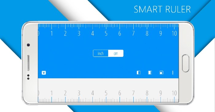
The user interface (UI) and user experience (UX) of the application are critical for user adoption and satisfaction.
The success of any application, including an AI-powered distance measurement tool, hinges significantly on its user interface (UI) and user experience (UX). A well-designed UI/UX ensures users can easily understand, interact with, and derive value from the application. This involves thoughtful consideration of visual design, interaction patterns, feedback mechanisms, and overall usability to foster user adoption and satisfaction.
Design Considerations for an Intuitive and User-Friendly Interface
Creating an intuitive and user-friendly interface is paramount for ensuring users can easily understand and utilize the distance measurement application. This involves several design considerations to enhance usability and provide a seamless experience.
- Visual Cues: Clear visual cues are essential for guiding users and providing feedback.
- Measurement Display: The primary measurement should be prominently displayed, using a clear and readable font size and style. The units of measurement (e.g., meters, feet, inches) should be clearly indicated next to the numerical value.
- Progress Indicators: A progress bar or animation should visually represent the measurement process, indicating the application is actively calculating the distance. This reduces user uncertainty and provides a sense of progress.
- Calibration Feedback: During calibration, visual cues, such as a color-coded status bar (e.g., green for successful, red for failure) or animated prompts, should guide the user through the process.
- Error Indicators: In case of measurement errors, the application should display clear and concise error messages, possibly accompanied by visual indicators like a change in the background color of the measurement display or an icon.
- Measurement Units: Allowing users to select their preferred units of measurement (e.g., metric or imperial) is crucial for global usability.
- Unit Selection: The application should offer a straightforward method for selecting and switching between measurement units, ideally through a dedicated settings menu or a toggle button within the main interface.
- Default Settings: The application should default to a common unit of measurement based on the user’s region or device settings, if available, to avoid immediate confusion upon first use.
- Calibration Tools: Calibration tools are necessary to ensure the accuracy of the measurements, especially when using sensors with inherent variability.
- Calibration Prompts: The application should provide clear and step-by-step instructions for the calibration process, including visual aids or animations to guide the user.
- Calibration Targets: The application may require users to measure a known distance during calibration. It should offer options for entering the actual known distance and compare it to the measured distance for the calibration.
- Calibration History: The application should store the calibration history and allow the user to revert to previous calibration settings, should the need arise.
UI Layouts and Interaction Patterns for Enhanced User Engagement
The choice of UI layouts and interaction patterns can significantly impact user engagement. Considering factors like screen size and user preferences is essential for creating an engaging and efficient user experience.
- UI Layout Examples:
- Single-Screen Layout: This layout displays all essential information, including the measurement value, unit selection, and calibration controls, on a single screen. This layout is suitable for applications with limited functionality and is simple to navigate.
- Tabbed Layout: This layout organizes the application’s features into different tabs, such as “Measure,” “Settings,” and “History.” This layout is suitable for applications with more complex features and functionalities.
- Overlay Layout: This layout displays the measurement information as an overlay on the camera feed. This is suitable for augmented reality (AR) based distance measurements, providing a seamless and immersive user experience.
- Interaction Patterns:
- Gesture Controls: Implement intuitive gesture controls for starting/stopping measurements, zooming, and switching between different modes. For example, a single tap could start the measurement, while a long press could recalibrate.
- Voice Commands: Incorporating voice commands to initiate measurements, change units, or access settings can improve usability, especially for hands-free operation.
- Haptic Feedback: Providing haptic feedback, such as a gentle vibration when a measurement is completed or an error occurs, can enhance the user’s awareness of the application’s status.
Incorporating Feedback Mechanisms for Measurement Accuracy and Error Handling
Feedback mechanisms are crucial for informing users about measurement accuracy and potential errors, ensuring a positive and reliable user experience.
- Visual Alerts:
- Accuracy Indicators: Displaying a confidence interval or a visual indicator of measurement uncertainty (e.g., a color-coded bar) can help users assess the reliability of the measurement.
- Error Messages: Clearly displaying error messages when measurements are not possible or have potential problems. These could be triggered by low light conditions, sensor interference, or other factors.
- Auditory Alerts:
- Measurement Completion Tone: A distinct sound, such as a “beep” or a chime, can signal the completion of a measurement.
- Error Notification Sound: A different sound can be used to indicate a measurement error, alerting the user to potential problems.
- Calibration Feedback:
- Calibration Status: Provide clear visual and/or auditory feedback during the calibration process to indicate success or failure.
- Calibration Warnings: Display warnings if the calibration process is not performed correctly or if the calibration data is questionable.
The deployment of the application across various platforms and devices is essential for reaching a wide audience.
Reaching a broad user base requires careful consideration of platform compatibility and hardware optimization. This ensures accessibility and a consistent user experience across diverse devices. The deployment strategy should address both software and hardware limitations to maximize the application’s usability and performance.
Developing for iOS and Android
Developing the application for both iOS and Android requires adapting to each platform’s unique characteristics. This involves using platform-specific features and addressing inherent limitations.
- Platform-Specific Features: iOS leverages the Swift and Objective-C programming languages, along with the iOS SDK, providing access to features like Core Motion for motion tracking and ARKit for augmented reality. Android, built on Java and Kotlin, utilizes the Android SDK, offering access to similar features through the Android sensor framework and ARCore. The choice of language and framework influences development time, performance characteristics, and the availability of specific APIs.
For instance, using ARKit on iOS can provide more seamless integration with the device’s camera and sensor data compared to some cross-platform AR solutions.
- Platform Limitations: iOS has a more controlled hardware ecosystem, leading to potentially more consistent performance profiles across devices. Android, with its diverse hardware manufacturers and device specifications, presents challenges in optimizing the application for varying CPU, GPU, and sensor configurations. This can necessitate more extensive testing and profiling to ensure optimal performance on a wide range of devices. Fragmentation in Android versions also means the application must be compatible with multiple API levels.
- UI/UX Considerations: iOS adheres to the Human Interface Guidelines, dictating design principles and user interaction patterns. Android follows Material Design guidelines, which also define UI/UX standards. Adapting the application’s UI to align with these platform-specific guidelines is essential for providing a native user experience.
- Deployment and Distribution: iOS applications are distributed through the App Store, requiring adherence to Apple’s review process. Android applications are primarily distributed through the Google Play Store, with options for sideloading and third-party app stores. The distribution process affects user acquisition, update frequency, and the application’s visibility.
Optimizing for Hardware Configurations
Optimizing the application for different hardware configurations is critical for ensuring smooth and responsive operation across a range of devices. This involves addressing CPU and GPU performance and managing sensor data efficiently.
- CPU Performance: CPU optimization involves efficient code execution, reducing unnecessary computations, and optimizing algorithms. Profiling tools, such as Xcode Instruments for iOS and Android Studio Profiler for Android, can identify performance bottlenecks. Techniques include:
- Code Profiling: Identify slow functions and optimize them.
- Thread Management: Utilize multithreading to parallelize computationally intensive tasks.
- Memory Management: Minimize memory allocation and deallocation to prevent garbage collection pauses.
- GPU Performance: GPU optimization focuses on rendering efficiency. This includes reducing the number of draw calls, optimizing shader programs, and utilizing texture compression. Techniques include:
- Draw Call Reduction: Batching similar objects to reduce the number of draw calls.
- Shader Optimization: Optimizing shaders to reduce computational complexity.
- Texture Optimization: Using appropriate texture formats and compression techniques.
- Sensor Data Management: Efficient sensor data management is crucial for battery life and responsiveness. This involves:
- Sensor Fusion: Combining data from multiple sensors to improve accuracy and robustness.
- Data Filtering: Applying filtering techniques to reduce noise and improve data quality.
- Sampling Rate Optimization: Adjusting sensor sampling rates to balance accuracy and power consumption.
Device Compatibility Table
The following table provides an example of device compatibility and illustrates the factors influencing the application’s usability. This table should be updated regularly as new devices are released.
| Device | Operating System | Screen Size (inches) | Sensor Capabilities | Compatibility Notes |
|---|---|---|---|---|
| iPhone 14 Pro | iOS 16+ | 6.1 | Accelerometer, Gyroscope, Magnetometer, LiDAR Scanner | Full Compatibility: High performance, access to all features. |
| Samsung Galaxy S23 | Android 13+ | 6.1 | Accelerometer, Gyroscope, Magnetometer, Barometer | Full Compatibility: High performance, access to all features. |
| iPad Air (5th generation) | iPadOS 15+ | 10.9 | Accelerometer, Gyroscope, Magnetometer | Full Compatibility: Larger screen enhances AR experiences. |
| Google Pixel 6a | Android 12+ | 6.1 | Accelerometer, Gyroscope, Magnetometer | Full Compatibility: Good performance on mid-range hardware. |
| iPhone SE (3rd generation) | iOS 15+ | 4.7 | Accelerometer, Gyroscope, Magnetometer | Limited Compatibility: Smaller screen, may impact AR experience. |
| Samsung Galaxy A13 | Android 12+ | 6.6 | Accelerometer, Gyroscope, Magnetometer | Limited Compatibility: Performance may be affected on lower-end hardware. |
Addressing the ethical implications of using AI in distance measurement applications is of utmost importance.: Artificial Intelligence App For Measuring Distance
The integration of Artificial Intelligence (AI) into distance measurement applications presents not only technological advancements but also significant ethical considerations. As these applications become more prevalent, it is crucial to address the potential for misuse, ensuring user privacy, fairness, and responsible data handling. This necessitates a thorough examination of data collection practices, algorithm design, and deployment strategies to mitigate potential harms.
Potential Privacy Concerns Related to User Data
The operation of AI-powered distance measurement applications often relies on the collection and processing of user data, raising several privacy concerns. Understanding the types of data collected and the methods used for data storage and security is essential for assessing and mitigating these risks.The types of data that might be collected include:
- Location Data: This is the most fundamental data type, typically obtained via GPS, Wi-Fi triangulation, or cellular network data. This data is critical for the application’s core functionality, enabling distance calculations.
- Sensor Data: Data from onboard sensors like accelerometers, gyroscopes, and cameras can be utilized to refine distance measurements. For instance, data from accelerometers can help track movement patterns, and camera data can be used for object recognition to estimate distances.
- User Profile Data: This may include information like user demographics, device type, and usage patterns. This data is often collected for personalization and analytics, which may not directly relate to distance measurement but could be used to infer sensitive information.
- Biometric Data (Potential): In advanced applications, facial recognition or other biometric data might be used for identification or to enhance the user experience. However, the use of biometric data raises significant privacy concerns due to its sensitivity.
Data storage and security methods:
- Data Storage: User data can be stored locally on the device, in the cloud, or a combination of both. The choice of storage method impacts security considerations. Cloud storage often offers scalability and accessibility but requires robust security measures to prevent data breaches. Local storage provides greater user control but can be vulnerable if the device is lost or compromised.
- Data Encryption: Encryption is a critical security measure used to protect data at rest and in transit. Data at rest encryption protects data stored on devices or servers. Data in transit encryption protects data while being transmitted over networks, ensuring that it is unreadable to unauthorized parties.
- Access Controls: Implementing strict access controls ensures that only authorized personnel can access user data. This involves defining user roles, setting up authentication mechanisms (e.g., multi-factor authentication), and regularly auditing access logs.
- Network Security: Securing the network infrastructure is crucial to prevent unauthorized access to user data. This involves using firewalls, intrusion detection systems, and regularly updating security patches.
- Data Minimization: Collecting only the data that is necessary for the application’s functionality is essential. This principle, known as data minimization, helps reduce the potential attack surface and minimizes the impact of data breaches.
Measures to Protect User Privacy
To promote responsible data handling, several measures can be implemented to protect user privacy in AI-powered distance measurement applications. These measures aim to balance the functionality of the application with the rights of the users.Measures to protect user privacy include:
- Data Anonymization: This involves removing or altering personally identifiable information (PII) from the dataset to make it impossible to identify individual users. Techniques like pseudonymization, where identifiers are replaced with pseudonyms, can be used. Differential privacy adds noise to data to prevent individual identification while preserving statistical properties.
- Data Encryption: As previously mentioned, encryption is essential for protecting user data. It ensures that even if data is accessed by unauthorized parties, it is unreadable without the proper decryption keys. End-to-end encryption, where data is encrypted on the user’s device and decrypted only by the intended recipient, provides the highest level of security.
- Consent Management: Obtaining informed consent from users before collecting and using their data is crucial. This involves providing clear and concise information about what data will be collected, how it will be used, and the user’s rights regarding their data. Consent management systems allow users to manage their preferences and revoke consent at any time.
- Transparency: Being transparent about data collection and usage practices builds trust with users. This involves providing clear privacy policies, explaining how data is used in the application, and being responsive to user inquiries about data privacy.
- Data Minimization: Only collecting the data that is essential for the application’s functionality minimizes the risk of data breaches and misuse. This involves regularly reviewing data collection practices and deleting data that is no longer needed.
- Regular Audits and Security Assessments: Conducting regular audits and security assessments helps identify vulnerabilities and ensure that privacy measures are effective. This involves testing the application’s security, reviewing data handling practices, and assessing compliance with privacy regulations.
Potential for Bias in AI Algorithms and Mitigation Strategies
AI algorithms, particularly those based on machine learning, can be susceptible to bias, which can lead to unfair or discriminatory outcomes. This bias can arise from various sources, including biased training data, algorithm design choices, and societal biases reflected in the data. Addressing this potential bias is crucial to ensure fairness and prevent discrimination in distance measurement applications.Potential sources of bias:
- Biased Training Data: If the data used to train the AI model reflects existing societal biases, the model will likely learn and perpetuate those biases. For example, if a dataset primarily contains data from a specific demographic group, the model may perform poorly for other groups.
- Algorithm Design Choices: The design of the algorithm itself can introduce bias. For instance, the choice of features, the selection of model parameters, and the evaluation metrics used can all influence the outcome and potentially lead to biased results.
- Feedback Loops: If the AI model is used in a way that reinforces existing biases, it can create a feedback loop, exacerbating the problem over time. For example, if a distance measurement application is used to allocate resources, biased measurements can lead to unfair distribution.
Steps to mitigate bias:
- Dataset Curation: This involves carefully selecting and preparing the data used to train the AI model. The goal is to ensure that the dataset is representative of the diverse population and free from systematic biases. This may involve collecting data from different demographic groups, removing biased features, and weighting data points to reduce the impact of overrepresented groups.
- Model Evaluation: Thoroughly evaluating the AI model’s performance across different demographic groups is essential to identify and mitigate bias. This involves using fairness metrics, such as equal opportunity and demographic parity, to assess the model’s performance. If biases are detected, the model can be retrained or adjusted to improve fairness.
- Bias Detection Tools: Utilize specialized tools and techniques for identifying and quantifying bias in AI models. These tools can analyze the model’s behavior, identify sensitive attributes, and measure the impact of the model on different groups.
- Explainable AI (XAI): Employing XAI techniques helps to understand how the AI model makes decisions. By providing insights into the model’s reasoning, XAI can help identify potential sources of bias and ensure that the model is making fair and transparent decisions.
- Regular Audits: Conducting regular audits of the AI model and its performance is essential to monitor for bias and ensure that fairness is maintained over time. These audits should involve assessing the model’s accuracy, fairness, and compliance with ethical guidelines.
Real-world applications of this technology span diverse fields, showcasing its versatility.
The versatility of AI-powered distance measurement applications is demonstrated by their broad applicability across various sectors. This technology’s ability to accurately and efficiently measure distances, combined with its adaptability to different environments and use cases, makes it a valuable tool in numerous industries. The following sections detail specific applications, highlighting their functionalities and the benefits they provide.
General Applications
AI-powered distance measurement finds application in various scenarios, streamlining tasks and enhancing user experiences. This technology offers precise measurements, enabling automation and improving efficiency across different fields.
- Measuring Room Dimensions: The application can accurately determine the length, width, and height of rooms. This is achieved by processing sensor data, such as data from LiDAR or stereo cameras, and employing algorithms to calculate the spatial dimensions.
This functionality is useful for interior design, real estate, and home improvement, where accurate measurements are crucial for planning and decision-making. - Estimating Object Size: The AI can estimate the size of objects in the real world. By analyzing sensor data, the application can determine the dimensions of objects, facilitating inventory management and asset tracking.
For instance, in a warehouse setting, this feature can be used to automatically measure the dimensions of packages, improving efficiency in the logistics process. - Assisting in Augmented Reality (AR) Applications: The application can seamlessly integrate with AR applications, providing accurate distance data to enhance user interaction. This data can be used to accurately place virtual objects in the real world, improving the realism and usability of AR experiences.
An example is placing virtual furniture in a room using AR, allowing users to visualize how the furniture fits before making a purchase.
Applications in Construction
The construction industry benefits significantly from the integration of AI-powered distance measurement. This technology can streamline processes, improve accuracy, and enhance overall efficiency.
- Measuring Distances for Blueprints: The application can automatically measure distances from construction sites and correlate them with blueprints. This allows for real-time verification of the accuracy of construction and helps in identifying discrepancies between the design and the actual construction.
This can significantly reduce the risk of errors and rework, saving time and costs. - Estimating Material Quantities: The application can accurately calculate the quantities of materials required for construction projects. By analyzing the dimensions of the construction site and the building plans, the application can provide precise estimates of the required materials, such as concrete, bricks, and steel.
This feature can help to optimize material procurement, reducing waste and minimizing costs. - Monitoring Construction Progress: The application can be used to monitor the progress of construction projects. By continuously measuring distances and comparing them with the project schedule, the application can provide real-time updates on the progress of the construction.
This can help project managers to identify potential delays and take corrective actions promptly, ensuring that the project stays on track.
Applications in Retail
Retail businesses can leverage AI-powered distance measurement to optimize operations, improve customer experience, and increase sales. The technology provides valuable insights into space utilization and customer behavior.
- Measuring Shelf Space: The application can measure the available shelf space in retail stores, providing insights into product placement and optimization. This data allows retailers to better allocate shelf space, ensuring optimal product visibility and maximizing sales potential.
The measurement of shelf space can also be integrated with inventory management systems to automatically trigger restocking when necessary. - Tracking Customer Movement: The application can track customer movement within a store, providing valuable data on traffic patterns and areas of interest. This data can be used to optimize store layouts, product placement, and marketing efforts.
By understanding how customers move through the store, retailers can make informed decisions about product placement and promotions. - Providing Product Recommendations: Based on customer movement and product interactions, the application can provide personalized product recommendations. This feature can enhance the shopping experience and increase sales.
For example, if a customer lingers near a particular product, the application can suggest complementary products or provide additional information about the product.
The process of testing and validation is critical for ensuring the accuracy and reliability of the application.
Ensuring the accuracy and reliability of an AI-powered distance measurement application requires a rigorous testing and validation process. This process involves a series of carefully designed experiments and analyses to identify and correct any errors, ensuring the application meets its intended performance criteria across various conditions and scenarios. Thorough testing is essential for building user trust and confidence in the application’s ability to provide accurate and dependable distance measurements.
Testing Methods for Validating Accuracy
Several testing methods are employed to validate the accuracy of the distance measurements provided by the application. These methods involve comparing the application’s output with known, reliable references and employing statistical analyses to quantify the performance.
- Comparison with Ground Truth Measurements: This method involves comparing the application’s distance measurements with a known “ground truth” or reference measurement. This could involve using a calibrated measuring tape, laser rangefinder, or a high-precision surveying instrument to establish the true distance. The application’s measurements are then compared to these ground truth values.
- Procedure: Establish a series of distances, ranging from short to long, and measure each using both the application and the ground truth method. For example, measure distances of 1 meter, 5 meters, 10 meters, and 20 meters, and repeat measurements multiple times.
- Data Analysis: Calculate the error (difference between the application’s measurement and the ground truth) for each measurement. Analyze the error distribution (e.g., mean error, standard deviation) to assess the application’s accuracy and precision.
- Example: If the application consistently underestimates the distance by 0.1 meters, a systematic error is present.
- Statistical Analysis: Statistical analysis is crucial to quantify the application’s performance and identify potential biases or inconsistencies.
- Error Metrics: Common error metrics include:
- Mean Absolute Error (MAE): The average of the absolute differences between the application’s measurements and the ground truth.
MAE = (1/n)
– Σ |measured distance – ground truth distance|where n is the number of measurements.
- Root Mean Squared Error (RMSE): The square root of the average of the squared differences between the application’s measurements and the ground truth. RMSE gives more weight to larger errors.
RMSE = √(1/n
– Σ (measured distance – ground truth distance)²) - Standard Deviation of Error: Measures the spread of the errors, indicating the precision of the application.
- Statistical Tests: Perform statistical tests (e.g., t-tests, ANOVA) to determine if the errors are statistically significant or if there are differences in accuracy across different distances or environmental conditions.
- Example: Calculate the MAE and RMSE to quantify the overall accuracy of the application. A lower MAE and RMSE indicate higher accuracy.
Procedures for Error Identification and Correction, Artificial intelligence app for measuring distance
Identifying and correcting errors is a continuous process of refining the application’s performance. This involves systematically analyzing errors, implementing corrective measures, and re-testing to ensure improvements.
- Error Logs: Implement comprehensive error logging to capture information about measurement errors.
- Data to be Logged: Log the measured distance, the ground truth distance (if available), the sensor data, the time of the measurement, and any relevant environmental conditions (e.g., lighting, temperature).
- Analysis: Regularly review the error logs to identify patterns or trends in the errors. For example, errors might be correlated with specific environmental conditions or certain distance ranges.
- Example: An error log might reveal that the application consistently underestimates distances in low-light conditions.
- User Feedback: Incorporate user feedback to identify issues and areas for improvement.
- Feedback Mechanisms: Provide users with a way to report errors or provide feedback (e.g., a feedback form within the application).
- Analysis: Analyze user feedback to identify common issues or usability problems.
- Example: Users might report that the application is inaccurate when measuring distances to moving objects.
- Iterative Refinement: The process of error correction should be iterative.
- Error Analysis: Analyze the identified errors to determine the root cause.
- Implementation of Corrective Measures: Implement corrective measures, such as:
- Algorithm Adjustments: Modify the algorithms to correct for systematic errors or improve the handling of noisy sensor data.
- Sensor Calibration: Calibrate the sensors to improve accuracy.
- User Interface Improvements: Improve the user interface to make the application easier to use or to provide clearer feedback to the user.
- Re-testing: Re-test the application after implementing corrective measures to verify that the errors have been corrected.
Testing Plan with Scenarios and Expected Outcomes
A well-defined testing plan is essential to ensure the application’s thorough evaluation. This plan should include specific testing scenarios, expected outcomes, and address edge cases and environmental variations.
- Testing Scenarios: The testing plan should include a variety of scenarios to evaluate the application’s performance.
- Distance Range: Test the application across a range of distances, from short distances (e.g., 1 meter) to long distances (e.g., 100 meters or more, depending on the application’s intended use).
- Object Types: Test the application with different types of objects, including stationary objects, moving objects, and objects with varying surface characteristics (e.g., reflective, non-reflective, textured).
- Environmental Conditions: Test the application under various environmental conditions, including:
- Lighting: Vary the lighting conditions from bright sunlight to low-light conditions.
- Temperature: Test the application at different temperatures.
- Weather: Test the application in different weather conditions (e.g., rain, fog, snow).
- Obstructions: Test the application with various obstructions, such as objects blocking the line of sight between the sensor and the target.
- Edge Cases: Address edge cases that represent unusual or challenging conditions.
- Rapid Motion: Test the application’s ability to measure distances to objects moving at high speeds.
- Extreme Distances: Test the application’s performance at the maximum and minimum distances it is designed to measure.
- Multiple Objects: Test the application’s ability to distinguish between multiple objects in the field of view.
- Expected Outcomes: Define the expected outcomes for each testing scenario.
- Accuracy Targets: Specify the acceptable error margins for each testing scenario. For example, the application might be required to have an MAE of less than 0.05 meters for distances up to 10 meters.
- Performance Metrics: Define the performance metrics to be measured, such as MAE, RMSE, and the percentage of measurements within the acceptable error margin.
- Example Testing Scenario:
- Scenario: Measure the distance to a stationary, non-reflective object at a distance of 10 meters in direct sunlight.
- Expected Outcome: The application should measure the distance with an MAE of less than 0.05 meters.
- Procedure: Measure the distance 100 times using both the application and a calibrated laser rangefinder.
- Data Analysis: Calculate the MAE and RMSE.
The considerations surrounding data security are vital for protecting user information.
Data security is paramount in any AI-powered application, especially one that handles potentially sensitive user data, such as location information. The accuracy and reliability of distance measurements are intrinsically linked to the integrity of the data used to calculate them, and the privacy of the user. Robust security measures are crucial not only to protect user data from malicious actors but also to maintain user trust and comply with increasingly stringent data privacy regulations.
Failure to adequately address security vulnerabilities can lead to significant reputational damage, legal ramifications, and financial losses.
Security Threats to the Application
The application faces various security threats that can compromise user data and system functionality. These threats necessitate a multi-layered security approach.
- Data Breaches: Unauthorized access to and exfiltration of user data is a primary concern. This can occur through vulnerabilities in the application’s code, the underlying infrastructure, or through social engineering attacks. Successful data breaches can expose sensitive information like location history, potentially leading to identity theft or stalking. An example is the 2017 Equifax data breach, which exposed the personal information of millions of individuals, highlighting the devastating consequences of inadequate data security.
- Malware Attacks: Malware, including viruses, worms, and Trojans, can be introduced through various means, such as malicious code embedded in the application itself or through phishing attacks targeting users. Malware can be used to steal user credentials, modify application behavior, or compromise the underlying infrastructure. A classic example is the Stuxnet worm, which targeted industrial control systems, demonstrating the potential for malware to cause significant physical damage.
- Unauthorized Access: This encompasses various scenarios, including attempts to bypass access controls, exploit authentication weaknesses, or gain unauthorized access to system resources. This can be achieved through brute-force attacks, exploiting vulnerabilities in authentication mechanisms, or through insider threats. For instance, a disgruntled employee with access to user data could potentially leak or misuse it.
- Denial-of-Service (DoS) and Distributed Denial-of-Service (DDoS) Attacks: These attacks aim to make the application unavailable to legitimate users by overwhelming the system with traffic. A successful DoS or DDoS attack can disrupt service, impacting user experience and potentially leading to financial losses. DDoS attacks often leverage botnets, networks of compromised computers, to launch large-scale attacks.
- Man-in-the-Middle (MitM) Attacks: In MitM attacks, attackers intercept communication between the user and the application, potentially stealing sensitive data or manipulating the information exchanged. This can be achieved through techniques such as eavesdropping on unencrypted network traffic or exploiting vulnerabilities in network protocols.
Security Measures for Protecting User Data
Implementing robust security measures is essential to mitigate the threats described above and protect user data. These measures should be continuously reviewed and updated to adapt to evolving threats.
- Encryption: Data encryption is fundamental to protecting data confidentiality. All data, both in transit and at rest, should be encrypted using strong encryption algorithms, such as AES-256. This includes encrypting data stored in databases, transmitted over networks, and stored on user devices. For example, HTTPS (HTTP Secure) uses TLS/SSL encryption to secure communication between the user’s device and the application’s servers.
- Access Controls: Implementing strict access controls is critical to limiting access to sensitive data and system resources. This includes using strong passwords, multi-factor authentication (MFA), and role-based access control (RBAC). RBAC ensures that users only have access to the data and functionalities necessary for their roles. For instance, an administrator would have different access privileges than a regular user.
- Regular Security Audits: Periodic security audits should be conducted by independent security professionals to identify vulnerabilities and assess the effectiveness of security measures. These audits should include penetration testing, vulnerability scanning, and code reviews. The results of these audits should be used to remediate identified vulnerabilities and improve security posture.
- Secure Coding Practices: Following secure coding practices during application development is essential to prevent vulnerabilities from being introduced in the first place. This includes input validation, output encoding, and avoiding common security flaws, such as SQL injection and cross-site scripting (XSS). Developers should be trained on secure coding principles and regularly review their code for vulnerabilities.
- Network Security: Implementing robust network security measures is crucial to protect the application’s infrastructure. This includes using firewalls, intrusion detection and prevention systems (IDS/IPS), and regularly updating network devices. Network segmentation can also be used to isolate sensitive data and system resources.
- Data Minimization: Collecting and storing only the data necessary for the application’s functionality is crucial for minimizing the risk of data breaches. This includes deleting data when it is no longer needed and avoiding the collection of unnecessary personal information.
- Incident Response Plan: Developing and implementing an incident response plan is crucial to effectively respond to security incidents. This plan should Artikel the steps to be taken in the event of a security breach, including containment, eradication, recovery, and post-incident analysis. Regular testing of the incident response plan is also essential.
Ensuring Compliance with Data Privacy Regulations
Compliance with data privacy regulations, such as GDPR and CCPA, is crucial to protect user privacy and avoid legal penalties. This requires a proactive approach to data management and privacy.
- Data Privacy Impact Assessments (DPIAs): Conducting DPIAs is essential to identify and mitigate privacy risks associated with the application. DPIAs should be conducted before the application is deployed and updated regularly.
- Obtaining User Consent: Obtaining explicit consent from users for the collection and use of their personal data is a fundamental requirement of GDPR and CCPA. Consent must be informed, freely given, specific, and unambiguous. Users should be able to easily withdraw their consent at any time.
- Data Subject Rights: Providing users with the ability to exercise their data subject rights, such as the right to access, rectify, erase, and port their data, is crucial. This requires implementing mechanisms for users to request and manage their data.
- Data Retention Policies: Establishing and adhering to clear data retention policies is essential to comply with data privacy regulations. Data should only be retained for as long as it is necessary for the purposes for which it was collected.
- Data Breach Notification: Implementing procedures for notifying data protection authorities and affected users in the event of a data breach is crucial. The notification must be made within the timeframe specified by the relevant regulations.
- Data Processing Agreements (DPAs): Entering into DPAs with third-party data processors is essential to ensure that they are also compliant with data privacy regulations. DPAs should specify the data processing activities, the purposes of processing, and the security measures to be implemented.
- Regular Training: Providing regular training to employees on data privacy regulations and security best practices is essential to ensure that they understand their responsibilities and can handle user data securely.
The potential for future advancements in this technology is immense, opening up new possibilities.
The trajectory of AI-powered distance measurement applications is one of continuous evolution, driven by advancements in sensor technology, algorithmic sophistication, and integration with other cutting-edge fields. This ongoing progress promises to redefine how we interact with and understand spatial information, leading to applications previously unimaginable. The following sections delve into specific areas where significant advancements are anticipated, highlighting the transformative potential of this technology.
Integration with Augmented Reality, Virtual Reality, and Robotics
The synergistic combination of AI-powered distance measurement with augmented reality (AR), virtual reality (VR), and robotics holds considerable promise for enriching functionality and enhancing user experiences. This integration opens doors to immersive and interactive applications across a multitude of domains.
- Augmented Reality (AR): The fusion of distance measurement with AR allows for the precise overlay of digital information onto the real world. Imagine an AR application that uses the distance measurement app to accurately place virtual furniture in a room, ensuring correct scaling and placement before purchase. This would dramatically improve the user experience in e-commerce and interior design. Furthermore, in fields like construction and surveying, AR could visualize building plans overlaid on the physical site, providing real-time measurements and reducing errors.
- Virtual Reality (VR): VR environments can benefit significantly from accurate distance measurements. Applications like VR training simulations, where precise object interactions are critical, would become more realistic and effective. For example, a VR surgical simulation could use the distance measurement app to track the movement of virtual surgical tools with pinpoint accuracy, providing trainees with a highly realistic and immersive learning experience.
Games and entertainment could leverage this technology to create more interactive and responsive virtual worlds.
- Robotics: The incorporation of distance measurement into robotics systems is essential for navigation, object manipulation, and environmental awareness. Robots can utilize the app’s data to understand the distance to objects, allowing for precise movements and task execution. Consider a delivery robot that uses the app to accurately navigate through a complex environment, avoiding obstacles and delivering packages with greater efficiency.
In manufacturing, robots can use this technology to precisely assemble components, improving accuracy and reducing waste.
Advancements in AI Algorithms: Deep Learning and Reinforcement Learning
The ongoing development of AI algorithms, particularly in the realms of deep learning and reinforcement learning, is poised to significantly enhance the accuracy, efficiency, and robustness of distance measurement applications. These advanced techniques enable the creation of more sophisticated models capable of handling complex data and adapting to dynamic environments.
- Deep Learning: Deep learning algorithms, particularly convolutional neural networks (CNNs) and recurrent neural networks (RNNs), are ideally suited for processing the complex data streams generated by distance measurement sensors. CNNs can analyze visual data from cameras, enabling accurate distance estimation based on image features. RNNs can process time-series data from sensors like ultrasonic or LiDAR, improving the precision of measurements over time.
For example, a deep learning model trained on a large dataset of LiDAR scans could learn to compensate for atmospheric interference, leading to more accurate distance measurements in challenging environmental conditions.
- Reinforcement Learning: Reinforcement learning (RL) can be used to optimize the performance of distance measurement systems in dynamic environments. RL algorithms allow the system to learn from its interactions with the environment, continuously improving its measurement accuracy and efficiency. For instance, an RL-based system could learn to dynamically adjust the parameters of an ultrasonic sensor to compensate for changes in temperature or humidity, leading to more reliable measurements.
This technology can also be applied to sensor fusion, where RL algorithms can learn to optimally combine data from multiple sensors, such as cameras and LiDAR, to provide more accurate and robust distance measurements.
- Efficiency Improvements: Deep learning and reinforcement learning can also be applied to optimize the computational efficiency of distance measurement applications. By developing models that require fewer computational resources, the app can run on a wider range of devices, including those with limited processing power and battery life. This can be achieved through techniques such as model compression and quantization, allowing the app to run on smartphones and other portable devices.
Hypothetical Scenario: Smart City Applications
Envisioning a future smart city environment showcases the potential of AI-powered distance measurement applications. Consider a city that leverages this technology across various sectors.
- Traffic Management: The application, integrated with roadside sensors and vehicle-mounted devices, monitors traffic flow in real-time. By measuring the distance between vehicles, the system can detect congestion, optimize traffic light timing, and alert drivers to potential hazards. This leads to reduced traffic jams, shorter commute times, and improved road safety. Data collected from the system can also be used to predict traffic patterns and proactively adjust traffic management strategies.
- Urban Planning: The app can be used in urban planning to assess the impact of new construction projects. Using drones equipped with distance measurement capabilities, planners can create detailed 3D models of the city, allowing them to accurately measure the distance between buildings, assess the impact of new structures on sunlight and wind patterns, and ensure compliance with zoning regulations. This facilitates sustainable urban development and enhances the quality of life for city residents.
- Environmental Monitoring: The application can be used to monitor environmental conditions. Sensors deployed throughout the city can measure the distance to objects, such as trees and buildings, and use this information to assess air quality, track the spread of pollutants, and monitor the health of urban forests. The app can also be used to detect and monitor landslides and other natural disasters, providing early warnings and helping to protect residents.
- Waste Management: The technology can optimize waste collection routes. Sensors in waste bins can transmit distance data, indicating fill levels. This allows waste management companies to plan efficient collection routes, reducing fuel consumption and minimizing the environmental impact of waste disposal.
Exploring the competitive landscape helps in positioning the application effectively.
Understanding the competitive environment is paramount for the successful launch and sustained growth of any application. A thorough analysis of existing solutions, their strengths and weaknesses, and the identification of unique selling propositions (USPs) are critical steps in strategic planning. This involves assessing market trends, identifying potential threats, and capitalizing on opportunities to establish a strong market presence.
Existing Applications and Technologies with Similar Functionality
A detailed examination of current applications and technologies offering distance measurement capabilities reveals a diverse landscape, ranging from established players to emerging technologies. Understanding the advantages and disadvantages of each allows for a strategic differentiation of the AI-powered application.
- Smartphone-based Distance Measurement Apps: Applications utilizing the built-in cameras and sensors of smartphones are prevalent.
- Strengths: Accessibility (ubiquitous device availability), ease of use (intuitive interfaces), cost-effectiveness (utilize existing hardware).
- Weaknesses: Accuracy limitations (dependent on camera calibration and environmental factors), reliance on ambient light conditions, potential for parallax errors.
- Examples: Apps that use AR (Augmented Reality) features to measure distances by overlaying virtual rulers or objects onto the real world. Their performance depends heavily on the accuracy of the AR tracking algorithms.
- Laser Distance Meters: These handheld devices use laser beams to measure distances with high precision.
- Strengths: High accuracy, fast measurement times, long measurement ranges.
- Weaknesses: Cost (more expensive than smartphone apps), requires direct line of sight, potential safety concerns related to laser exposure.
- Examples: Bosch GLM series, Leica DISTO series. These devices are widely used in construction, surveying, and other professional fields.
- Ultrasonic Distance Sensors: These sensors emit ultrasonic sound waves and measure the time it takes for the echo to return to calculate distance.
- Strengths: Relatively inexpensive, can measure distance in non-transparent environments.
- Weaknesses: Accuracy limitations (affected by temperature and humidity), shorter measurement ranges compared to laser meters, potential for interference from other ultrasonic sources.
- Examples: Commonly used in robotics, parking sensors, and object detection systems.
- Computer Vision and Machine Learning-Based Solutions: These systems leverage cameras and advanced algorithms to estimate distances.
- Strengths: Potential for high accuracy, can measure distances in complex environments, can incorporate multiple data sources (e.g., stereo vision).
- Weaknesses: Computational complexity (requires significant processing power), sensitivity to lighting conditions, need for training data.
- Examples: Self-driving car systems use stereo vision and other sensors to determine distances to surrounding objects. This approach often involves deep learning models trained on vast datasets.
Comparison of Application Features and Performance with Competitors
A direct comparison of the AI-powered application’s features and performance against its competitors highlights its unique value proposition and competitive advantages. This analysis should consider key metrics such as accuracy, speed, ease of use, and cost.
- Accuracy: The application’s accuracy should be comparable to or better than smartphone-based apps, ideally approaching the accuracy of laser distance meters, depending on the chosen sensors and algorithms. For example, the application can leverage AI-powered image analysis to correct for lens distortion and improve the accuracy of distance measurements, potentially outperforming traditional methods in challenging lighting conditions.
- Speed: The application should provide real-time or near-real-time distance measurements.
- Ease of Use: The application should offer an intuitive user interface (UI) and user experience (UX), making it easy for users to obtain distance measurements without requiring specialized training. For example, a simplified calibration process or an augmented reality interface can enhance usability.
- Cost: The application’s cost should be competitive, considering both the initial cost (if any) and the ongoing operating costs.
- Unique Selling Points (USPs) and Competitive Advantages: The application should possess unique features that differentiate it from the competition. For instance:
- AI-driven error correction: Utilize AI to automatically correct for environmental factors (e.g., lighting, temperature) to improve measurement accuracy.
- Multi-sensor fusion: Integrate data from multiple sensors (e.g., camera, IMU) to enhance robustness and accuracy in various conditions.
- Cross-platform compatibility: Offer compatibility across various platforms and devices to maximize accessibility.
SWOT Analysis of the Application
A SWOT analysis provides a structured framework for evaluating the application’s internal and external factors, guiding strategic decision-making.
| Strengths |
|
|---|---|
| Weaknesses |
|
| Opportunities |
|
| Threats |
|
Closing Summary
In conclusion, the artificial intelligence app for measuring distance stands as a testament to the transformative power of AI, promising to reshape industries and redefine spatial interactions. From its foundation in computer vision principles to its potential for future integration with augmented reality and robotics, this technology presents a vast landscape of opportunities. The considerations of data security, ethical implications, and rigorous testing will ensure the reliable and responsible deployment of this technology, ushering in a new era of precise and efficient distance measurement.
Questions Often Asked
What is the primary advantage of using AI for distance measurement?
AI enables sophisticated processing of sensor data, leading to more accurate and robust distance estimations, especially in complex or dynamic environments, and can also automate and streamline the process of distance measurement.
What types of sensors are most commonly used in these applications?
Cameras (for monocular and stereo vision), LiDAR (for 3D mapping), and ultrasonic sensors are commonly integrated, each offering different advantages in terms of range, accuracy, and cost.
How is data privacy ensured in an AI-powered distance measurement app?
Data privacy is maintained through measures such as data anonymization, encryption, consent management, and compliance with data privacy regulations like GDPR and CCPA.